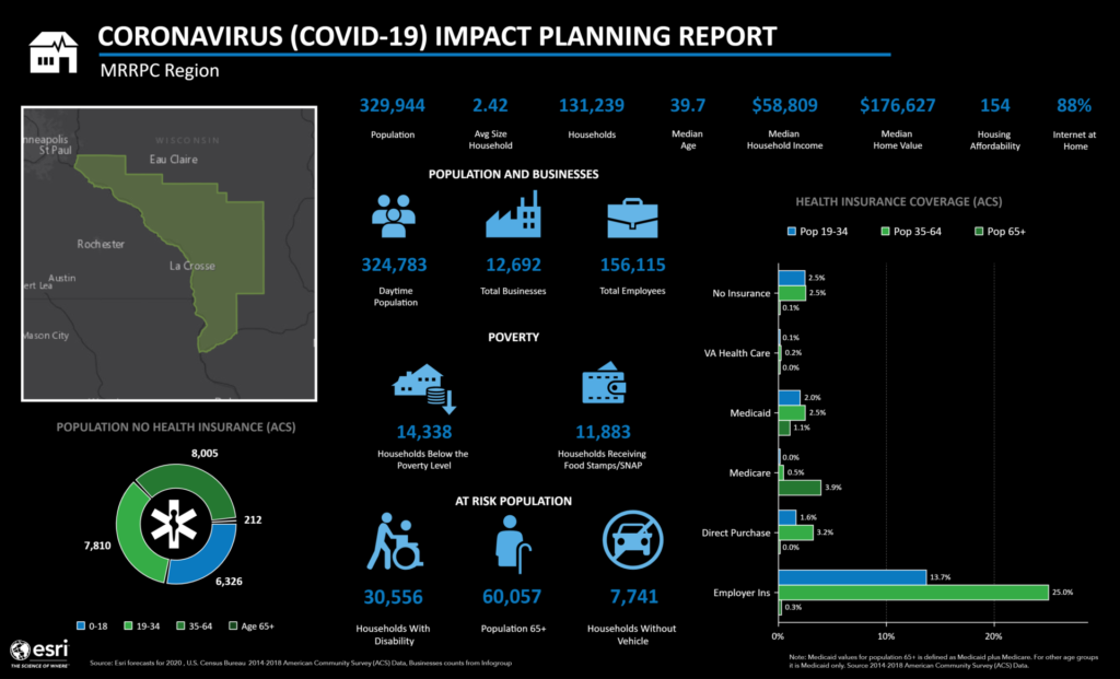
MRRPC provides an array of geographic information system (GIS) data for projects involving land use planning, transportation planning, emergency planning, and community development. Examples of services we offer are custom maps and visualizations such as online maps, ArcGIS Hub Site development, Story Maps, brochures, and graphics.
Examples:

